A Road Trip Through the Scottish Highlands
A ten-day loop from Inverness through Assynt, Durness and Torridon — how long the driving actually takes, where to base, and the single-track rules that decide whether the route is enjoyable or exhausting.
Scotland · Published November 2025 · 6 min read
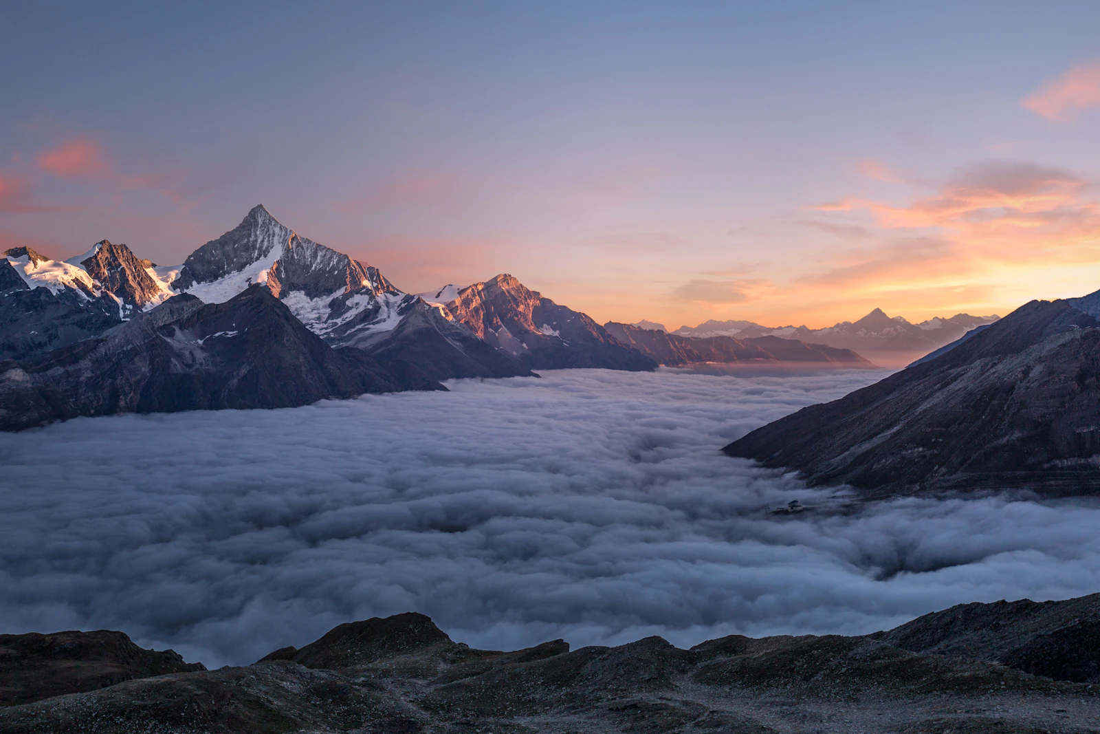
The North Coast 500 follows roughly 516 miles of public road out of Inverness and back, around the northern mainland. It is a marketing route rather than a designated highway, which means the signposting is minimal and the itinerary is entirely the driver's to set.
The common mistake is treating it as a five-day circuit. Most of the road is single track with passing places, average speeds are far lower than the map suggests, and the western sections are where the driving is worth doing slowly. This guide sets out a ten-day version that adds Assynt, Torridon and Glen Affric, and explains the practical constraints — fuel, accommodation, weather, midges — that shape the trip.
Best time to drive the Highlands
May, early June and September are the strongest windows. Daylight is long, most seasonal accommodation and ferries are running, and the worst of the summer traffic on the single-track sections has not arrived. Midges are active roughly from late May to early September and are worst on still, damp evenings near water — they affect stops and camping far more than driving.
July and August bring the heaviest traffic and the tightest accommodation. Late October to March gives empty roads and short daylight — around seven hours in December — with real snow and closure risk on high passes such as Bealach na Bà. Winter driving is viable for confident drivers with a flexible plan, not for a fixed ten-day schedule.
How to arrive and what to hire
Inverness is the practical start. Inverness Airport has direct flights from several UK airports, and the rail line from Edinburgh and Glasgow takes about three and a half to four hours. Hire cars are available at both the airport and the city centre, and demand in summer is high enough that booking months ahead matters.
Take the smallest car the luggage allows. Single-track roads with passing places are far easier in a compact vehicle, and several of the most rewarding stretches — the Applecross pass, the Assynt coast road, the approach to Kylesku — are tight, steep and blind in places. Large motorhomes are discouraged on Bealach na Bà specifically, and the signed alternative via Shieldaig exists for that reason.
How long to stay
Ten days is the realistic minimum for a full loop that includes the north-west. Seven days is possible if the eastern coast is shortened; five days means most of the trip is spent behind the wheel.
A useful planning ratio is no more than three hours of driving a day, with two nights in at least three of the bases. The Highlands' weather changes fast enough that a second morning in the same place is often the difference between seeing a landscape and driving past cloud.
A ten-day route, stage by stage
Days one and two: Inverness to Torridon via Achnasheen, with a first full day walking below Liathach or Beinn Eighe. Day three: the Applecross peninsula, taking Bealach na Bà up and the coast road back through Shieldaig — a short distance that takes most of a day.
Days four and five: north to Ullapool, then into Assynt. This is the section most travellers underestimate: Suilven and Stac Pollaidh rise out of open moor as isolated shapes, and the minor coast road through Achiltibuie, Clachtoll and Drumbeg is slow, narrow and the best driving on the route.
Days six and seven: Kylesku, Scourie and Durness. Handa Island is reached by a short seasonal ferry from Tarbet, and Smoo Cave sits at the edge of Durness village. Cape Wrath, the north-westernmost point of mainland Britain, is reached only by a small passenger ferry across the Kyle of Durness followed by a minibus along the military road — a seasonal, weather-dependent half-day that cannot be driven in a private car.
Days eight to ten: east along the north coast through Tongue and Thurso, then south down the eastern seaboard via Helmsdale and Dornoch, which is faster road and a shorter day. Finish inland through Glen Affric, one of the largest remnants of Caledonian pine forest, before returning to Inverness.
Where to base the journey
Four bases work better than nine one-night stops: Torridon or Shieldaig for the west coast mountains, Ullapool for Assynt and the ferry connections, Durness or Scourie for the far north-west, and Inverness or Dornoch at either end.
Accommodation across the north-west is dominated by small guesthouses, B&Bs, inns with a handful of rooms, bothies and campsites. Capacity is genuinely limited, and in summer it is normal for a village to be fully booked months ahead. Wild camping is permitted under the Scottish Outdoor Access Code for small tents pitched responsibly, but that right does not extend to parking a campervan overnight at the roadside.
Driving rules and practical notes
Passing places are for passing and for letting faster traffic through — not for parking or photographs. The convention is that whichever vehicle is nearest a passing place stops, and pulling in on the left or waiting opposite a right-hand passing place are both correct. Sheep and deer are on the road at all hours, and the risk is highest at dawn and dusk.
Fuel is the other constraint. Filling stations in the north-west are widely spaced, several close in the early evening, and Sunday opening is limited. Refuel at half a tank rather than a quarter. Mobile coverage is patchy across Assynt and the far north; download offline maps before leaving Inverness.
Mistakes to avoid
Compressing the loop into five days, booking a large vehicle, and leaving accommodation to chance in July are the three that spoil the most trips. Driving the route clockwise or anticlockwise makes little difference; driving it in a hurry makes all of it.
The other common error is planning around distances rather than road types. Sixty miles of the A9 and sixty miles of the Drumbeg road are not the same day.
Related Atlas reading
This route sits within the Scenic Road Trips in Europe hub and the wider Road Trips catalogue. For a shorter, wilder North Atlantic drive, see Driving the Faroe Islands End to End; for island journeys that extend the same instinct, see Remote Islands in Europe for Slow Travellers.
The Unknown Atlas is independent. We do not accept payment for coverage — how we handle commercial links.
A practical layer
Planning this journey
- Where to stay
- Small guesthouses, restored village houses, pousadas, rural hotels, or unusual stays that fit the route.
- Best with
- A small hire car, especially for inland villages, coast roads, Alentejo, Serra da Estrela, and schist villages.
- Experiences nearby
- Guided walks, wine tastings, boat trips, local food experiences, small-group tours, or quiet cultural visits depending on the article.
- Useful add-ons
- Travel insurance, eSIM/data, offline maps, flexible ferry/flight planning, and enough cash for smaller villages.
Quiet planning notes — never a booking widget. See our disclosure.
Continue exploring
More from Scenic Road Trips in Europe

Road Trips
Driving the Faroe Islands End to End
Eighteen islands joined by subsea tunnels, causeways and small ferries — how the road network actually works, a seven-day route, and why the forecast should decide the itinerary before the map does.
Hidden Places
Quiet Places in the Algarve Away from the Crowds
Inland villages, lagoon islands and the Algarve edge of the Costa Vicentina — a careful reading list of the quieter Algarve, twenty minutes off the resort road.

Hidden Places
The Hidden Side of Santorini
Past the caldera and the cruise crowds, the island keeps a quieter life of inland villages, working vineyards, and beaches the guidebooks tend to skip.